 aktiv_admin
Navigating North Park’s Extensive Hiking Network
North Park features a comprehensive network of hiking trails designed for diverse skill levels, from casual exploration to strenuous ascents. With over 30 kilometers of maintained paths, the park offers varied terrain and unique ecological zones. Understanding these specific trail characteristics is vital for a safe and rewarding experience.
North Park’s Trail System Overview
North Park’s trail system spans approximately 32.5 kilometers across its 1,200-hectare landscape. Around 70% of trails traverse forested areas, offering significant shade, while 30% pass through open meadows and wetland edges. Trail surfaces are predominantly natural earth (75%), with gravel sections at 15% and paved segments making up 10% near access points. Average trail width is 1.5 meters. Elevation changes are generally moderate, averaging 3-5% gradient, though specific segments on the Highland Ridge Trail reach up to 12% over short distances. This contrasts with purely paved urban trails by demanding more varied footwear due to uneven surfaces.

Trail Difficulty and Specific Examples
North Park categorizes trails into Easy, Moderate, and Strenuous based on length, elevation, and terrain.
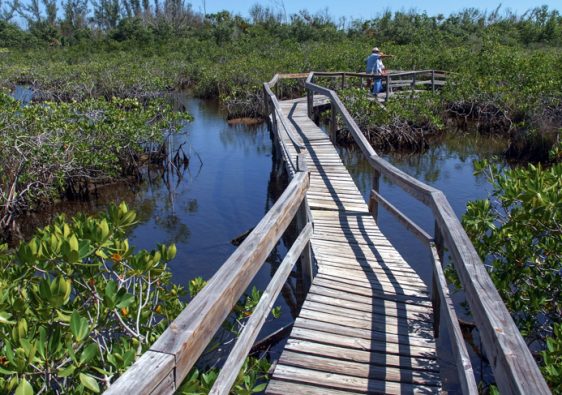
- Easy Trails: Under 3 km, <50m elevation gain, well-maintained. "Wetland Loop" (2.2 km, 2% avg gradient, boardwalks). Completion: 35-45 minutes. Requires minimal equipment.
- Moderate Trails: 3-8 km, 50-200m cumulative elevation. Uneven terrain, roots, rocks. "Forest Canopy Path" (5.8 km, 120m elevation). Completion: 1.5-2.5 hours. Demands better fitness and stable footwear than easy routes.
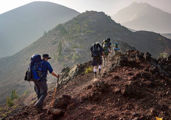
- Strenuous Trails: >8 km or >200m cumulative elevation. Rugged, obstacles, steep gradients (up to 12%). "Highland Ridge Trail" (10.5 km, 310m elevation) is the most challenging, featuring rocky, uneven terrain. Allocation: 3.5-5 hours. The trade-off is higher physical demand for superior panoramic views.
Route Selection and Navigational Precision
North Park offers popular routes with distinct experiences. The Lakeside Perimeter Trail (7.1 km, Moderate) is 60% packed gravel, 40% natural earth, 95m elevation gain. Signage every 0.5 km aids navigation. The Summit View Ascent (4.2 km one-way, Strenuous) gains 180m; initial 1.5 km is 8% gradient, transitioning to rugged 10-12%. While offering a 270-degree vista, its one-way nature doubles effective effort. The Valley Floor Connector (3.5 km, Easy-Moderate) links park sections via a 450m elevated boardwalk. Its minimal 1.5% gradient makes it a good connector but prone to mud.
Navigational tools are critical. Core trails are marked, but less prominent connectors require a physical map or GPS. Cellular service is intermittent in 30% of the park (deep valleys, dense forests). Relying solely on mobile navigation risks signal loss; printed maps are a reliable, zero-battery alternative.
Critical Preparation and Safety Protocols
Ensuring a safe and enjoyable hiking experience in North Park requires adherence to specific protocols.
- Hydration: For hikes >1.5 hours, carry minimum 1 liter water per person; 2-3 liters for strenuous routes in summer (>30°C).
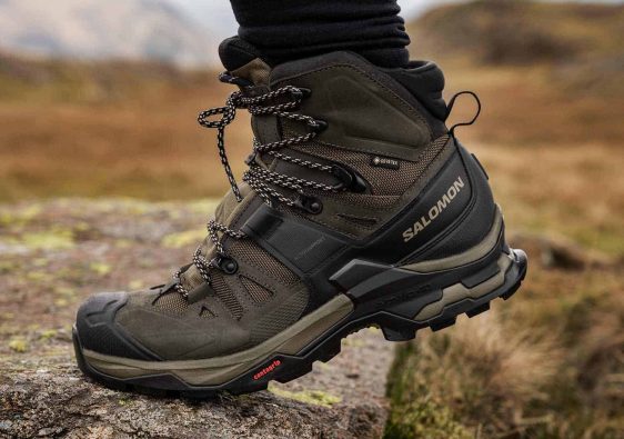
- Footwear: Sturdy, closed-toe hiking shoes with ankle support are critical for uneven terrain. Trail running shoes offer less stability, a technical trade-off.
- Layered Clothing: North Park’s weather can shift rapidly (10-15°C swings), requiring adaptable layers.
- Navigation: A physical map/compass or charged GPS with offline maps is essential. Cellular dead zones affect ~30% of the park.
- First-Aid: A compact kit is non-negotiable for all hikes, addressing common issues like blisters.
- Wildlife: Maintain distance; avoid feeding.
- Leave No Trace: Pack out all trash, stay on marked trails to prevent erosion.
These measures collectively reduce risk on varied trails compared to unprepared ventures.
Key Aspects of North Park’s Hiking Experience
- Diverse Trail Lengths: Options from 2.2 km easy loops to 10.5 km strenuous traverses.
- Varied Terrain: Includes natural earth, gravel, paved sections, and boardwalks.
- Significant Elevation Gains: Up to 310 meters on the Highland Ridge Trail.
- Intermittent Cellular Coverage: Expect reduced service in ~30% of the park.
- Multi-Use Pathways: Many trails are shared; user awareness is critical.
- Seasonal Accessibility: Some wetland trails may be muddy during spring thaw or heavy rain.
Common Mistakes to Avoid
- Underestimating Trail Difficulty: Even "Easy" trails require basic fitness.
- Inadequate Hydration: Not carrying enough water, leading to dehydration.
- Improper Footwear: Wearing casual shoes on uneven terrain increases injury risk.
- Sole Reliance on Mobile Devices: Risk of signal loss or battery drain.
- Deviating from Marked Trails: Can lead to getting lost or damaging ecosystems.
- Not Informing Others of Plans: Hinders rescue efforts in emergencies.
FAQ Section
Are dogs permitted on North Park’s hiking trails?
Yes, leashed dogs (max 2m leash) are permitted on all trails. Owners must clean up waste. This minimizes wildlife disturbance and maintains hygiene.
What is the best time of year to hike in North Park?
Late spring (April-May) and early autumn (September-October) are optimal (15-25°C). Spring offers wildflowers, autumn vibrant fall colors. Summer brings humidity/insects; winter hiking often necessitates microspikes due to ice.
Are there any accessible hiking trails in North Park for individuals with mobility challenges?
Yes, the "Riverside Promenade" (1.8 km paved loop, max 3% gradient) is wheelchair/stroller accessible. Portions of the "Wetland Loop" include 0.8 km of wide, stable boardwalks. These trails feature wider paths (min 2m) and benches every 200-300m for varied needs.